-
Załączniki bezpieczeństwa
Załczniki do produktuZałączniki dotyczące bezpieczeństwa produktu zawierają informacje o opakowaniu produktu i mogą dostarczać kluczowych informacji dotyczących bezpieczeństwa konkretnego produktu
-
Informacje o producencie
Informacje o producencieInformacje dotyczące produktu obejmują adres i powiązane dane producenta produktu.HELION
-
Osoba odpowiedzialna w UE
Osoba odpowiedzialna w UEPodmiot gospodarczy z siedzibą w UE zapewniający zgodność produktu z wymaganymi przepisami.
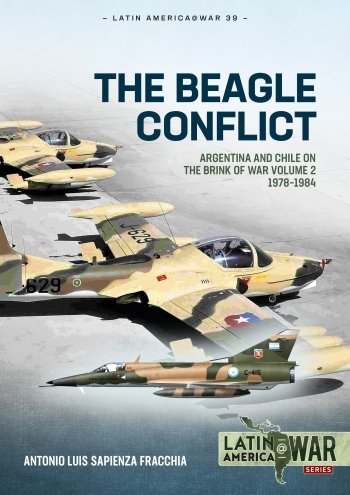
The Beagle Channel lies at the southernmost tip of South America and sovereignty over a number of islands there was hotly disputed between Argentina and Chile for much of the twentieth century. Navigation rights to this channel connecting the Atlantic and Pacific oceans were of considerable strategic value. In 1978, this dispute came within hours of breaking into large-scale open warfare between the two nations at sea, in the air and on land as Argentina launched Operación Soberanía (Operation Sovereignty).
Argentina’s plans involved far more than just seizing a few barely inhabited islands, however, and intended to strike deep into Chile in several locations along the length of the border between the two nations. In return, Chile planned to counterattack into northern Argentina to seize territory to be held as a bargaining chip for future negotiations. The plans of these two nations, with Argentina controlled by its Military Junta and Chile under the dictatorship of General Pinochet, threatened to draw in their Latin American neighbours.
The Beagle Conflict: Argentina And Chile On The Brink Of War Volume 2 1978-1984 provides a detailed examination of the militaries of Argentina and Chile at the time of the 1978 confrontation, of their plans and deployments for war, and of the negotiations and settlement through the offices of the Vatican that ultimately settled this dispute. This volume also examines further military developments up to 1984 as tensions between the Latin American neighbours eased.
The volume is illustrated with over 150 original photographs of the personalities, aircraft, ships and ground forces of the two nations, maps showing the plans for war, and specially commissioned colour artworks.


